Web Cams Show Bomb Cyclone Conditions and Coastal Flooding

We are just coming out of High tide and the beaches are fairing well use these web cams to check conditions.
(March 7, 2020 … 7:45 AM) … Inland the conditions don’t seem so bad, but offshore storm surge never does. The beaches were flooded to the dune line in most areas earlier this morning. You can use the area web cams to check conditions, or just run down to the beach and look. There are big waves and storm surge, but it is pretty mild in comparison to nor’easter conditions.
Rehoboth Beach web cam
Bethany Beach north surf web cam
The DelDOT cams are helpful as well. Beach combing is going to be great this weekend.
There are four DelDOT traffic cameras on The Charles W Cullen Bridge (Indian RIver Inlet Bridge) you can access on the DELDOT app. Use either your phone or computer online, if you screen shoot the camera feed on your phone, you can blow up the picture to see details. The interactive map is easier to use on your phone, but works fine on a computer.

Indian River Inlet as seen form the north tower DelDOT traffic cam ![deldot traffic cam, charles w cullen bridge, indian river inlet bridge, delware surf fishing,]()
Delaware seashore state park at Faithful Steward crossing DelDOT traffic cam 
Newly replenished beach at northside in Delaware Seashore State park, DelDOT traffic cam north tower ![web cam, bethany beach, delaware surf fishing]()
Bethany beach north surf web cam 
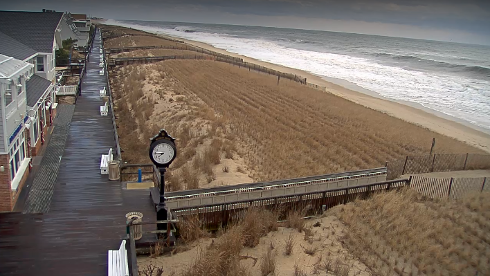
Rehoboth beach web cam 7:45 AM

Hazardous Weather Outlook
National Weather Service Mount Holly NJ
333 AM EST Sat Mar 7 2020
Delaware Beaches-Eastern Monmouth-Atlantic Coastal Cape May-
Coastal Atlantic-Coastal Ocean- 333 AM EST Sat Mar 7 2020
…COASTAL FLOOD ADVISORY IN EFFECT UNTIL 10 AM EST THIS MORNING…
This Hazardous Weather Outlook is for southern Delaware, central
New Jersey and southern New Jersey.
Kent-Inland Sussex-Delaware Beaches-
449 AM EST Sat Mar 7 2020

...COASTAL FLOOD ADVISORY REMAINS IN EFFECT UNTIL 10 AM EST THIS
MORNING...

* WHAT...Minor flooding is expected with around half a foot of
  inundation above ground level in low-lying areas near
  shorelines and tidal waterways.

* WHERE...Tidal areas in the Delaware counties of Sussex and
  Kent.

* WHEN...From 4:00 AM until 10:00 AM on Saturday.

* IMPACTS...In Sussex County, roadway flooding is possible in
  Fenwick Island, Dewey Beach, Bethany Beach, Lewes, Rehoboth
  Beach and at other locations along the ocean, bay and tidal
  tributaries. In Kent County, roadway flooding is possible in
  Woodland Beach, Bowers Beach, Kitts Hummock and at other
  locations along the bay and its tidal tributaries.

PRECAUTIONARY/PREPAREDNESS ACTIONS...

A Coastal Flood Advisory means that minor tidal flooding is
expected. Minor tidal flooding often results in some road
closures. Usually, the most vulnerable roadways will flood.

Do not leave your vehicle at a location that is prone to tidal
flooding. Do not drive your vehicle through flood waters. The
water may be deeper than you think it is. You will be putting
yourself in danger and your vehicle may be damaged, leading to
costly repairs.

Visit the Advanced Hydrologic Prediction Service at
water.weather.gov/ahps for additional water level and flood
impact information for your local tide gauge.

&&

Time of high total tides are approximate to the nearest hour.

Murderkill River at Bowers Beach
MLLW Categories - Minor 6.6 ft, Moderate 7.6 ft, Major 8.6 ft
MHHW Categories - Minor 0.9 ft, Moderate 1.9 ft, Major 2.9 ft

             Total      Total    Departure
 Day/Time    Tide       Tide     from Norm   Flood
            ft MLLW    ft MHHW       ft      Impact
 --------  ---------  ---------  ---------  --------
 07/07 AM     7.0        1.3       1.2      Minor
 07/08 PM     6.0        0.3       1.3       None
 08/09 AM     6.7        1.0       0.6      Minor
 08/09 PM     5.8        0.1       0.6       None
 09/10 AM     6.4        0.7       0.1       None
 09/10 PM     5.8        0.1       0.3       None

Delaware Bay at Lewes
MLLW Categories - Minor 6.0 ft, Moderate 7.0 ft, Major 8.0 ft
MHHW Categories - Minor 1.3 ft, Moderate 2.3 ft, Major 3.3 ft

             Total      Total    Departure
 Day/Time    Tide       Tide     from Norm   Flood
            ft MLLW    ft MHHW       ft      Impact
 --------  ---------  ---------  ---------  --------
 07/06 AM     6.5        1.8       1.6      Minor
 07/07 PM     5.4        0.8       1.4       None
 08/08 AM     6.4        1.8       1.2      Minor
 08/09 PM     4.8        0.2       0.4       None
 09/09 AM     5.3        0.7       0.0       None
 09/10 PM     4.9        0.2       0.2       None
Comments are closed.