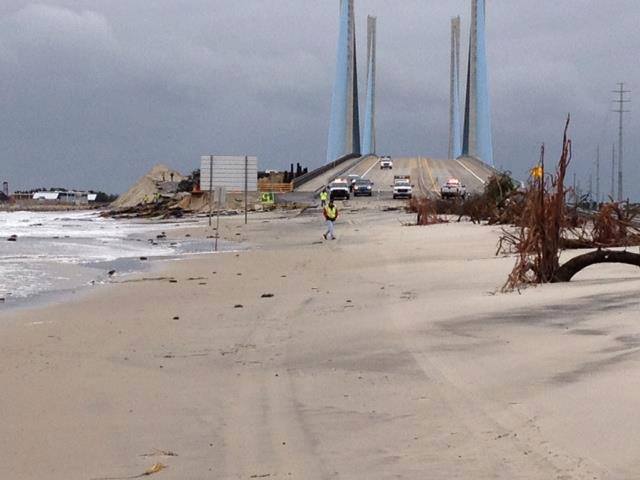
Sussex County Now Under Tropical Storm Watch

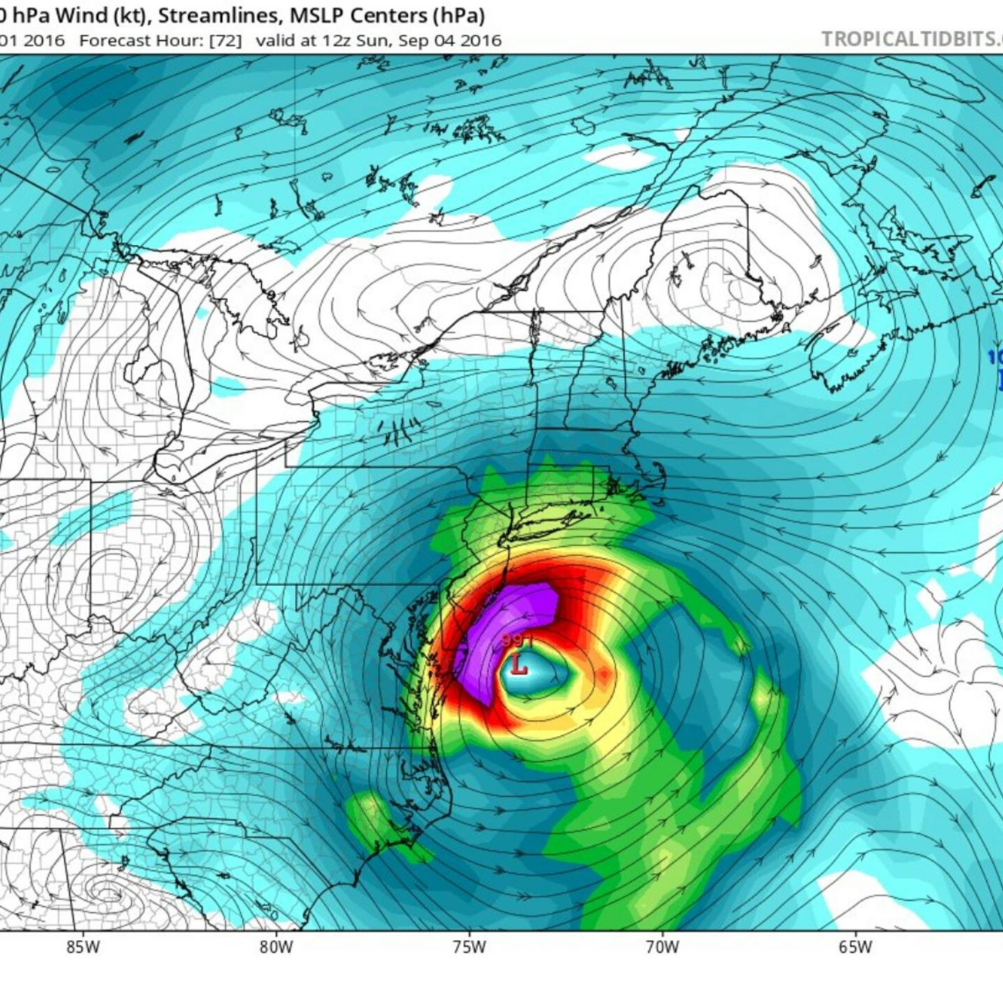
Hermine has been upgraded to a category 1 hurricane. It is expected to cross Florida and then head up the East coast. The problem for Delmarva will be if it turns into a nor’easter and not a fast moving tropical storm. So far all the conditions are there for it to become a nor’easter. It will slow down and stall at some point, hopefully off the coast. Hurricanes and tropical storms are fast moving, they will do some damage, flood and then leave. A nor’easter however will move slower, sit on top of us ,and push more and more water into the coast. Combined with the new moon, we will have some higher than normal tides anyway. If the storm hits during the high tide (11 PM Saturday night) and with heavy storm surge, we will see flooding into the inland bays. If it lasts for two or three high tides we will see some serious flooding. At this point it is too early to tell just how bad this will become. The height of the storm surge will be more than we have had the past few days. Beaches will flood, watch them at high tide. The inland bays will flood in all the normal spots we just don’t know for how long. We also don’t know rain potentials and that will add to the flooding. Ocracoke Island is under a mandatory evacuation. I do not know what Sussex county has planned as of yet. I would expect the parks to close drive on beaches if it gets bad. Honestly you would be crazy to drive onto a beach in a nor’easter, but then again some of my friends aren’t exactly sane. We will be storm chasing as always.
Anyone remember the potential nor’easter we had several years ago that turned into a hurricane hours before it hit this area. It was fast, but flooded us good then went away. The nor’easter that sat on us for five days a few years ago caused serious flooding. Nor’easters are worse for this area than hurricanes. The winds will push a lot of water into the inland bays and keep pushing in more. The water doesn’t leave at low tide and then more stacks up with high tide and the winds. The longer the storm sits with sustained winds more and more flooding occurs. As always we will keep you updated. Something we have done since hurricane Irene, when the weather channel and everyone else skipped over Delaware. Since then we always cover storms, Sandy was the next year after Irene. I don’t have to tell you how rough that one was, not just the storm, but covering it for seventy two straight hours. Be safe and smart this weekend. These storms can be mild, but deadly at the same time. If you would like to see how bad this area can flood from hurricanes use this interactive map, it puts things into perspective for worst case scenarios. Storm Surge Inundation (SLOSH Maximum of Maximums)
This web map displays a seamless national map of near worst case storm surge flooding (inundation) scenarios using the National Weather Service (NWS) SLOSH model maximum of maximums (MOMs) product for different hurricane wind categories at a high tide
Fish On!!
Rich King
Siesta Key Beach in Florida 6:30 PM …
Comments are closed.